a blue-green urban oasis
bachelor thesis
MJØSPROMENADEN
Scope
For my bachelor thesis, we teamed up with Gjøvik Municipality. Gjøvik came to us with the problem area: we have great parks, facilities and areas for unorganized physical activity. However, we experience that information about these is not good enough or accessible enough to the public.
This resulted in a communication strategy which includes several smaller steps, which will together result in encouragement to visit Mjøspromenaden. We used the process model “Designsløyfa” which is suitable for service design focused projects.
From early user insight we ended up with this problem formulation:
“What barriers exist that prevent incoming students from obtaining sufficient information about the Mjøspromenaden, and what measures can be implemented to minimize these barriers so that more students are encouraged to visit the Mjøspromenaden?”

Tools
For the project most of the insight took place in Figjam. Big parts of the ideation, as well as the prototypes were created in Figma. As a part of creating the area map and logo for the area, this was done in Adobe illustrator.
We used Trello for project and task managing, where we filled in different tasks from our Gantt diagram into Trello, and the assigned who was to complete which tasks. Discord was used for communication, as well as saving and sharing litterature and other helpfull articles.
Method
Prepare
Understand
Define
Ideate
Prototype
& test
Implement
How might we improve the perception of what the area is called, and where facilities are located?
How might we increase the level of knowledge and awareness about Mjøspromenaden?
How might we strengthen the perception and use of signs to and on Mjøspromenaden?
User insight
We started our insight by conducting ten user interviews. Here we asked them questions around four main themes: their relationship with nature and Gjøvik as a city, what they knew about Mjøspromenaden, their relationship to information about outdoor areas, and their relationship to facilities. During the interview we conducted a cognitiv map, to get an idea of how they saw and remembered the area.
The findings from the interview led to two personas with user journeys and a service blueprint. We boild down the finds to three “How might we” questions, which we used in our ideation process, and in a workshop we held with six students from the user group.
*personas based on our user interviews
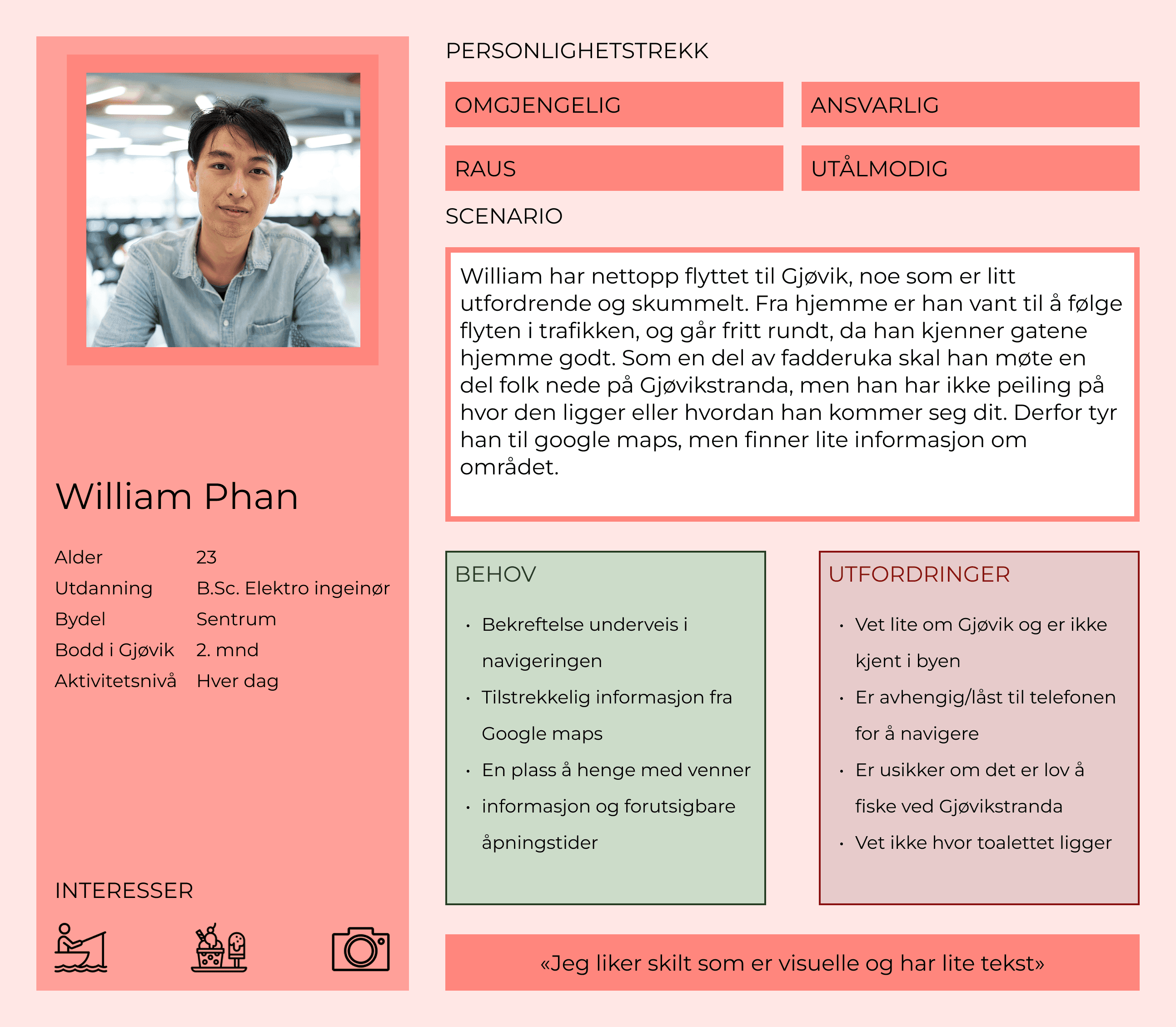
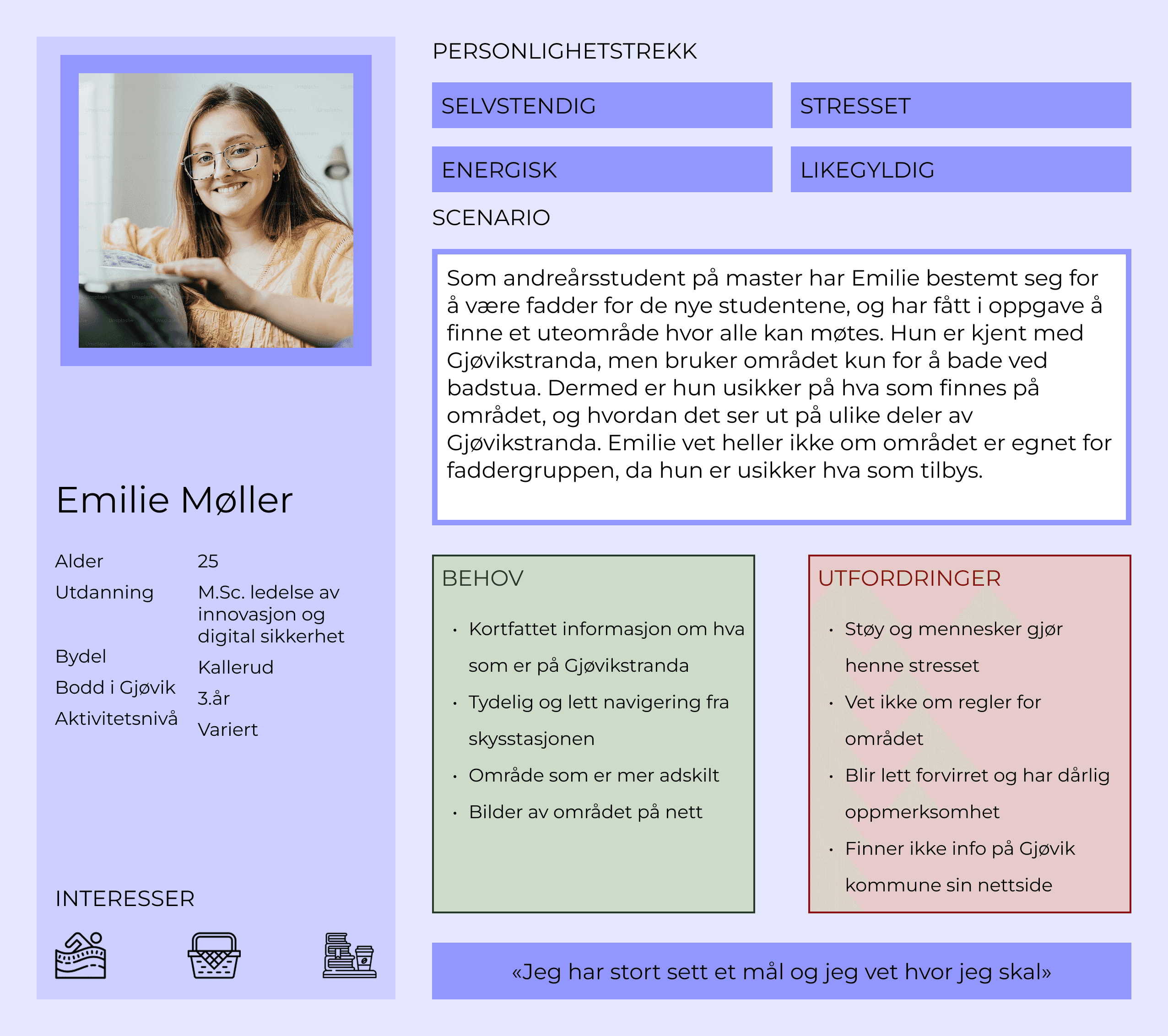


*user journey William
Workshop
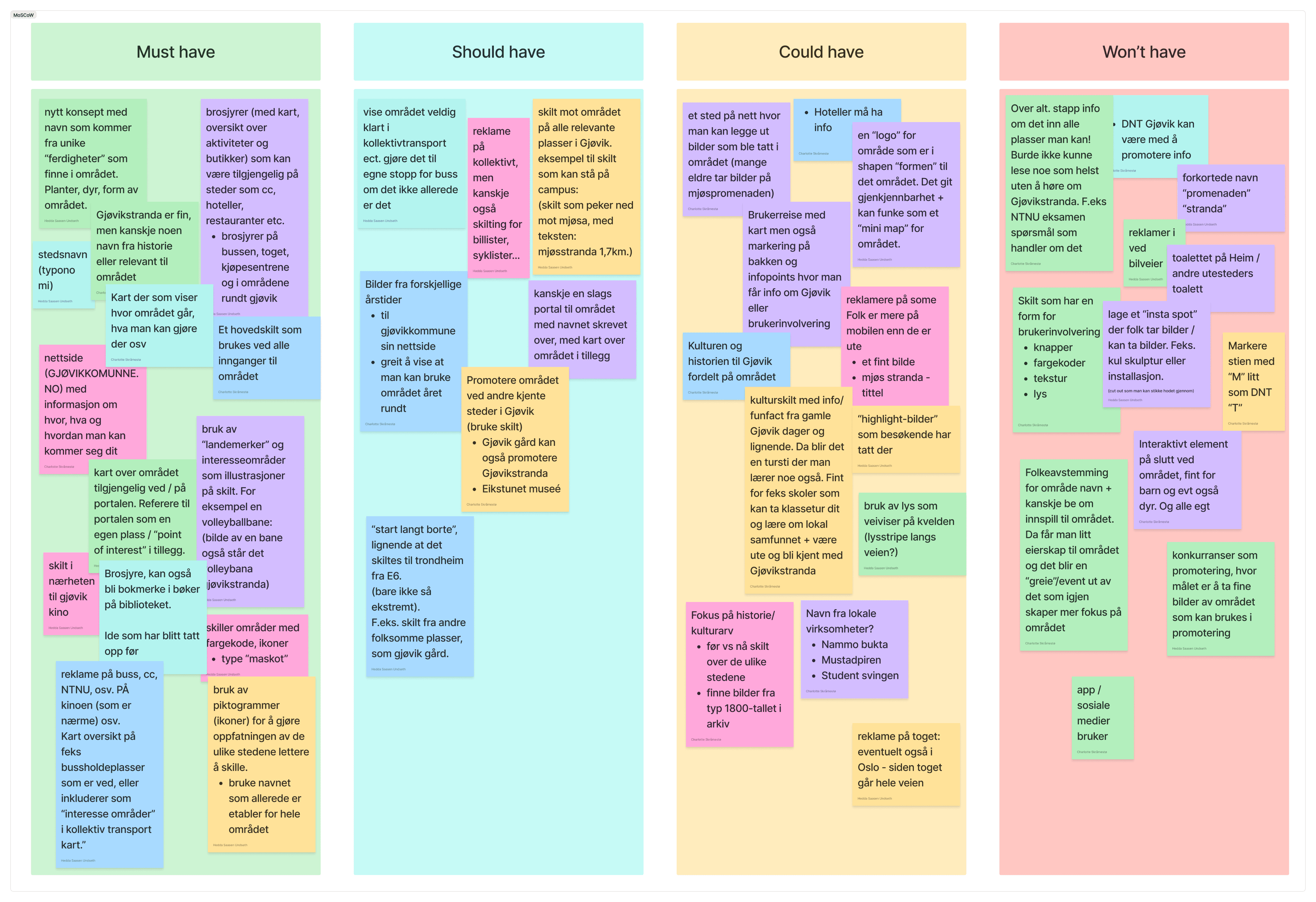
We did a workshop using the method brain writing, which left us with 108 ideas. We sorted these in a impact/effort matrix, before we sorted these ideas into a MoSCoW priority matrix.
After the prioritizing we started prototyping and testing our products, before we came up with our final product:
A communication strategy.
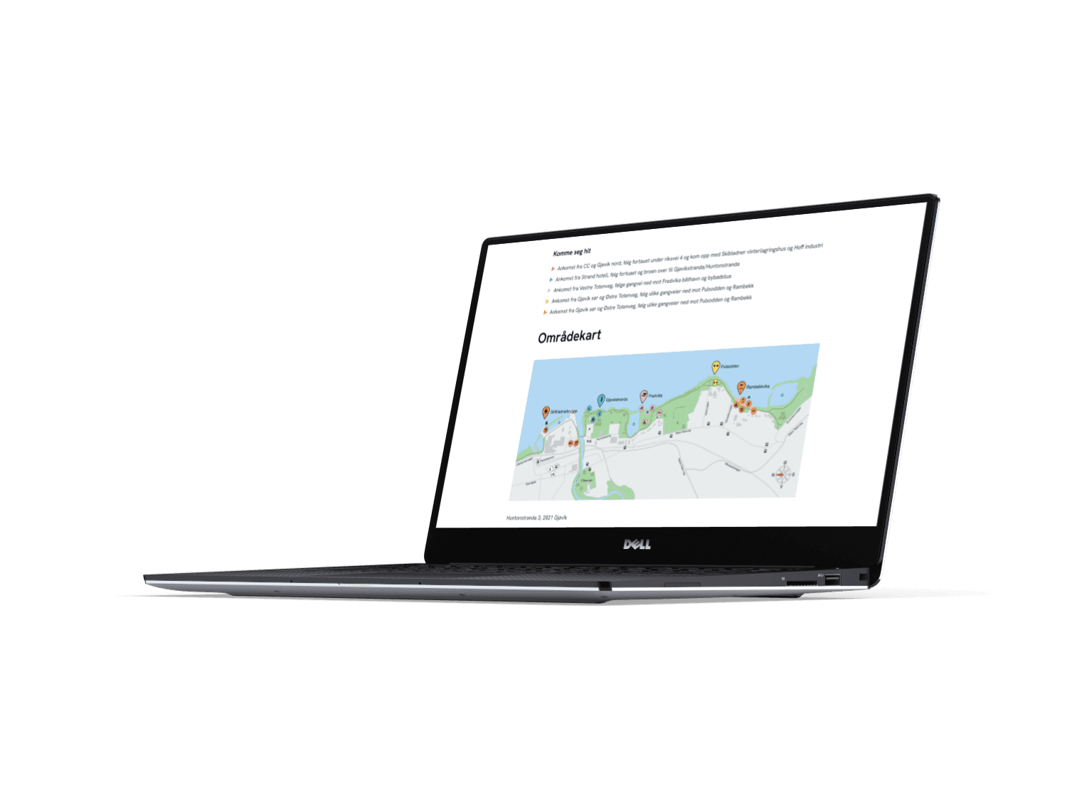
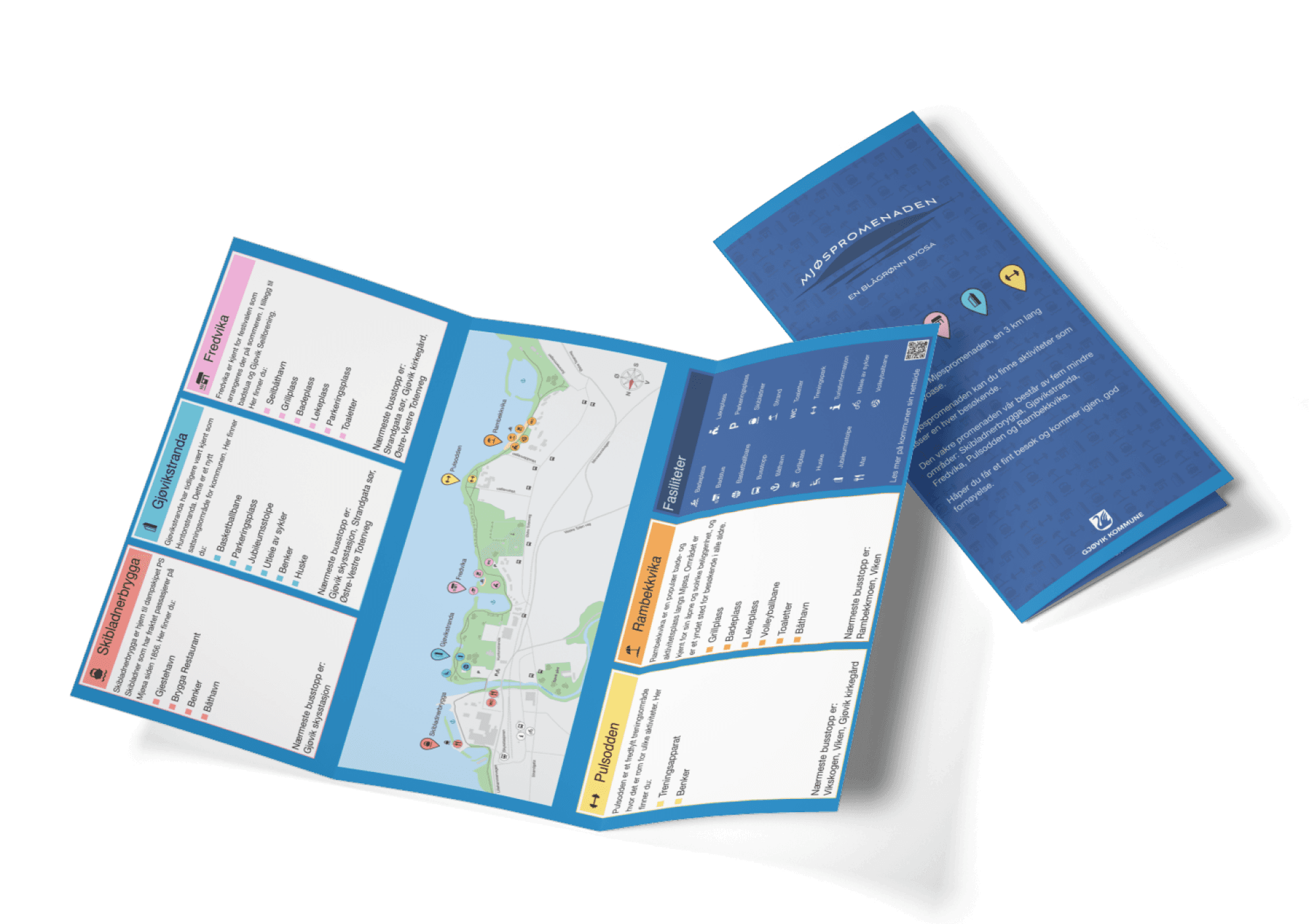
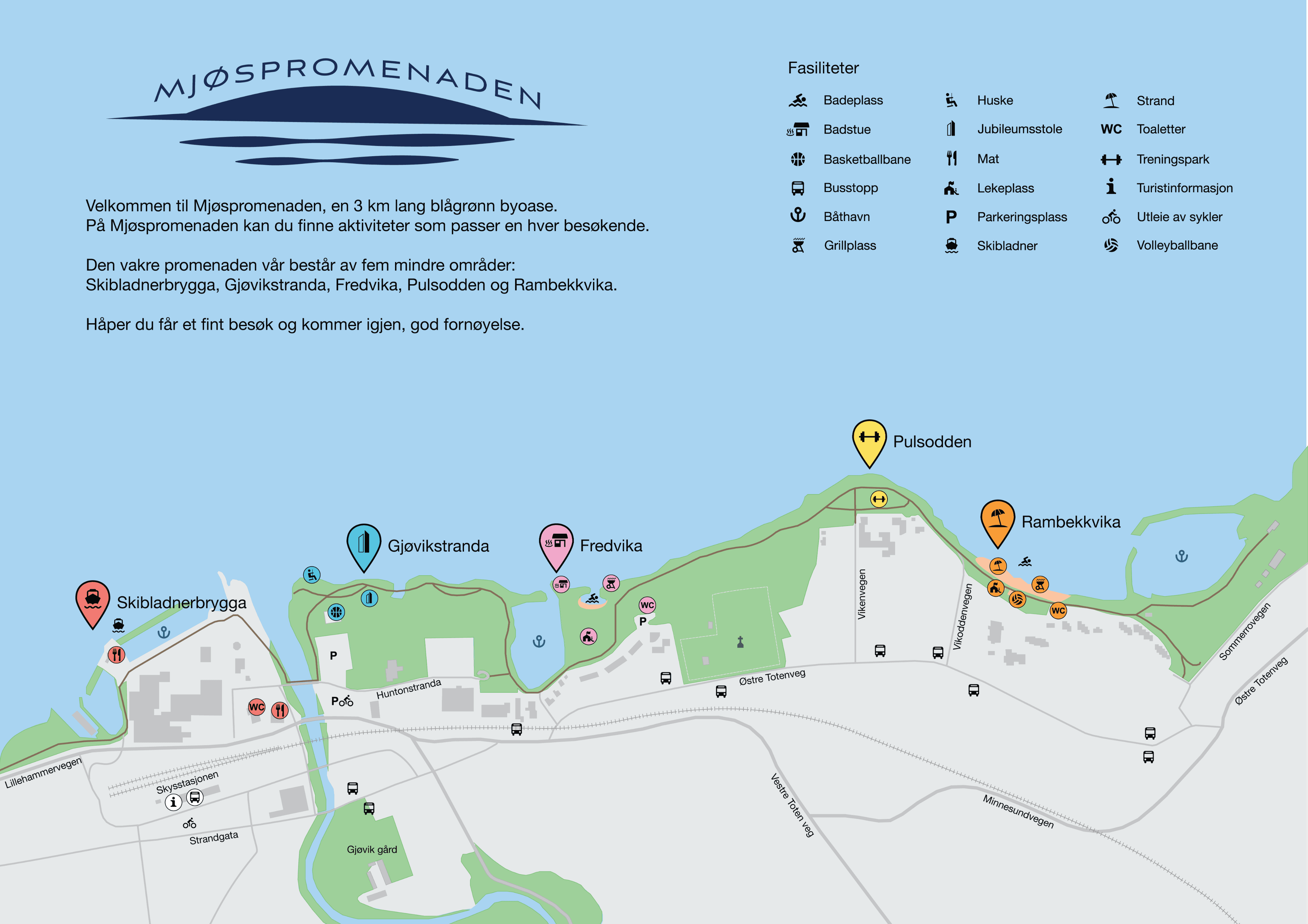
a map over the area was created, with icons that show facilities and where you find them, as well as the sub-areas and the main roads in Gjøvik.
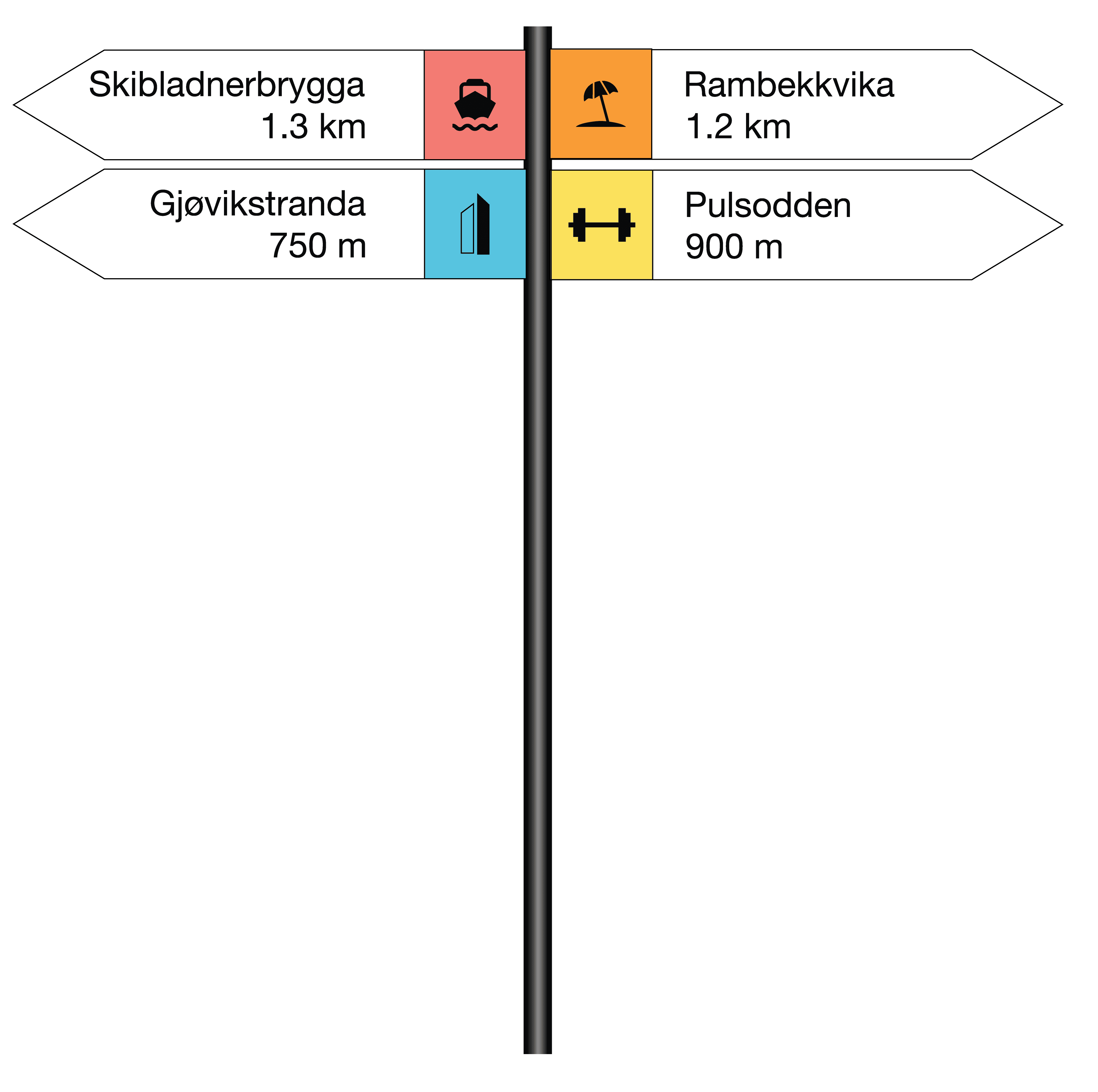
as an addition to this we created direction sign posts, these show how far it is to the different sub-areas from where you stand.
*name we created based in Norwegian linguistic tradition
Skibladnerbrygga
#FF867D
#57C4E0
Gjøvikstranda
#FFB0E3
Fredvika
#F99B36
Rambekkvika
#FFE366
Pulsodden*
The communication strategy
From the different fases of insight, ideation and testing, we ended up with the final result to the problem. Our communication strategy consists of:
implementation and stronger establishment of toponyms and landmarks, as well as dividing the area into smaller sub-areas.
a specific icon and color for each sub-area, the icon is a representation of the landmark.
we created a logo for the area to give it a stronger identity.
Logo for the area
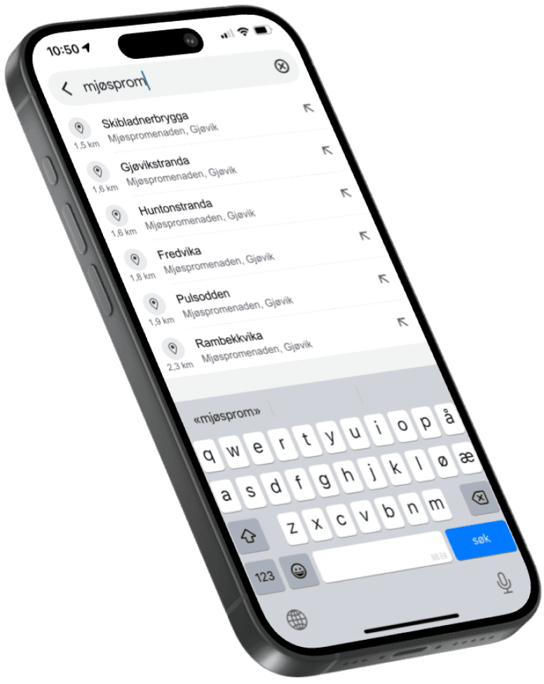
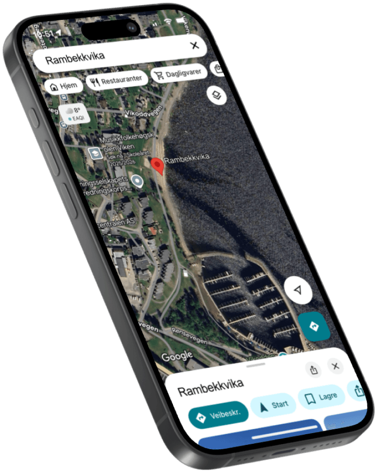
after this we created mock ups that show what Google Maps search will look like, after they create map pins for the sub-areas.
we created a new category on Gjøvik Municipalitys website, where we added several parks. Here Mjøspromenaden has its own page with all the information you need for the area and sub-areas.
the creation of a page for Mjøspromenaden as well as the map pins will make it easier to find the correct information when you do a Google Search. But we also want to introduce synonym rings, which will make sure the user ends up on our pages more easily.
What the search in Google Maps would look like, after creating the new map pins.
we also created a brochure based on the information you can find on the Municipalitiys website.
This project marks three years of education at the Norwegian University of Science and Technology.